

Visual Drift Distance Calculator for Model Rocketry app for iPhone and iPad
Developer: Peter Stanley
First release : 23 Mar 2015
App size: 12.02 Mb
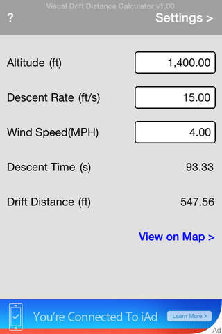
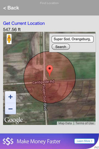
This calculates drift distance, based on given altitude, descent rate and wind speed. Then shows a satellite image of the users current or searched location at the center of a shaded circle overlay. The radius of the circle (from the center point out) represents the drift distance.
This can help show any potential hazards or obstacles in the recovery area.
Two use cases are:
1. Determine if the launch site is large enough for the given wind conditions, estimated altitude and descent rate. So if it looks like the rocket might drift into trees, water, etc... the user could try to increase the descent rate by using a smaller chute or streamer, or use a smaller rocket motor. Either change would result in a smaller smaller drift distance.
2. Determine a starting search area for rockets that have drifted out of view.
* The app requires an Internet connection and gps to acquire location. If an Internet connection is available, but the location still cant be determined, the last acquired location will be used. If that isnt available then the default is used, which is the Super Sod field in Orangeburg, SC. You can type an address or latitude/longitude coordinates in the map search box to display a different location.
* Use your rocketry calculating tool of choice to estimate altitude and descent rate.
* Supports multiple combinations of metric and imperial unit settings.